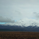
All the places we explored with Christine, Richard, Liam and Madeline are within the area known as the Colorado Plateau.
From St George we were also within this region and dramatic landforms were at every turn of the road. I described the initial places we visited within the Colorado plateau area in an earlier post. (particularly the north rim of the Gand Canyon)
Relatively early on Saturday morning we set out to explore the South rim of the canyon. This involved driving from Desert View camp site to various lookouts along the road which took us to the more popular and crowd Canyon Village. The first stop was right by our camp. Here we saw what looked like an Indian watch tower but was actually built in the 1930's. As the guide book said once the Indians were no longer a threat, safely away on reservations, the settlers discovered the value of their culture.

Liam, Murray and Richard took a shuttle bus to Hopi point which is beyond canyon Village, while Christine and I did some shopping. After tea we returned to the Desert View Lookout. A pleasant evening walk and interesting light.

We left the Grand Canyon on Sunday morning. On the way to the Navajo National Monument we stopped and looked at some dinasour footprints and bones near Tuba City, on Navajo land. At the Navajo National Monument we walked a short distance and saw some pueblo dwellings in a cave across a canyon.

We drove on to Monument Valley. In some ways I found this more spectcualar than the grand Canyon. However I do advise if sleeping in desert not to sleep with your head downhill from your feet. I woke feeling very odd and got up and spent the rest of the night sleeping on the camp chairs under the eating shelter. Quite comfortable actually and much cooler. It also meant I was able to watch the sunrise which was really special.

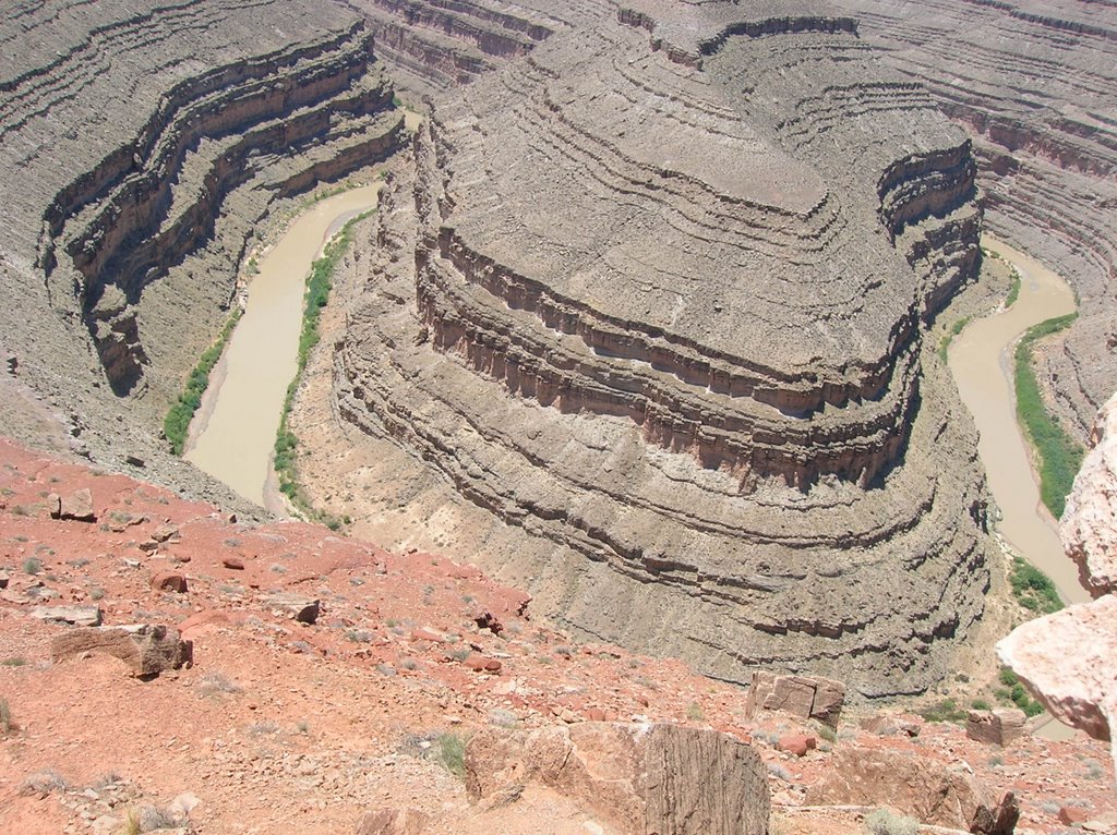
After leaving Monument Valley we stopped off at Goose Neck State park. This was like looking at a geomorphology text book but in a context of a whole region. I am sure I have been shown this site as an example of entrenched meanders many times.
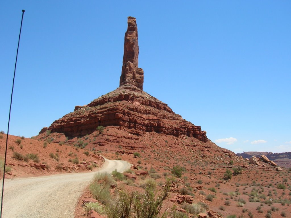
The Valley of the Gods was as the Rough Guide said 17 miles of dusty road but the landforms were interesting. While the Navajo thought they looked like warriors, Liam thought they looked like Policemen, along with a money with a hat. We back tracked a little to take the route that took us up the Moki Dugway . This was not my favourite drive but the view was great and the whole escarpment interesting.
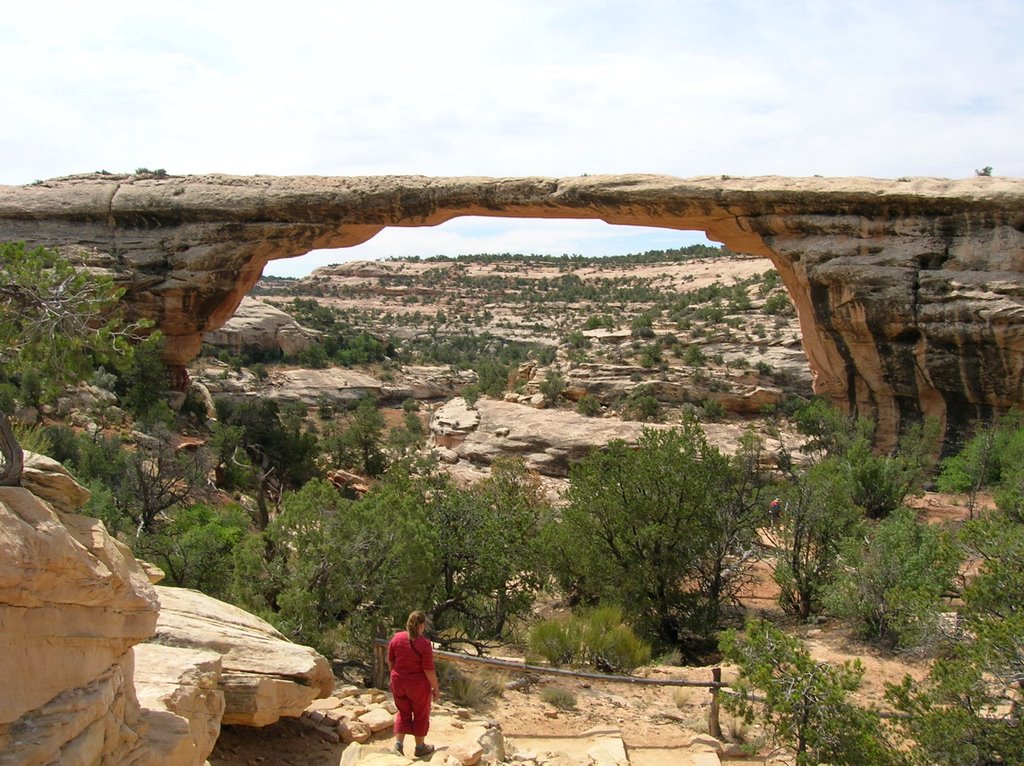
Natural Bridge National Monument has three natural bridges cut in the sandstone by meandering rivers along with plenty more evidence of human occupation. We left our camp early ( very early for Murray but coffee is good) and walked down to the Sapapu bridge. We looked Kachina Bridge and the Horseshoe Ruin from viewpoints short wolks from the road. We walked doen to the third bridge Owachomo. By this time it was getting hot and we were glad of the early start and the oranges etc we had carried.
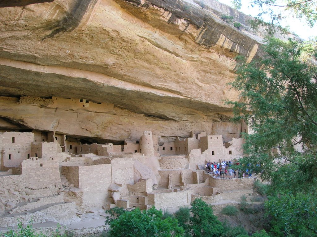
The next two sites we visited on the plateau focused on the human occupation of the plateau - Mesa Verde National Park and Bandelier National Monument. (For those interested in chronological order we travelled off the plateau, through the Rockies and on to Santa Fe, it is strictly not on the plateau, between these visits - I will write about this in a later post).
As with the other dwellings we had seen it is interesting to imagine the lives of the people. At Mesa Verde we took a guided tour of the Cliff Palace. After climbing around one understands why small children were kept strapped to backboards - Madeline was also firmly strapped into her backpack.


No comments:
Post a Comment